Atmospheric Alchemy: Unpacking China's Mid-Summer Weather Crucible
Dive deep into China's 'Seven Up, Eight Down' weather crucible. Explore atmospheric dynamics, topographic impact, and critical resilience strategies amid record-breaking summer extremes.

The Annual Reckoning: Understanding 'Seven Up, Eight Down'
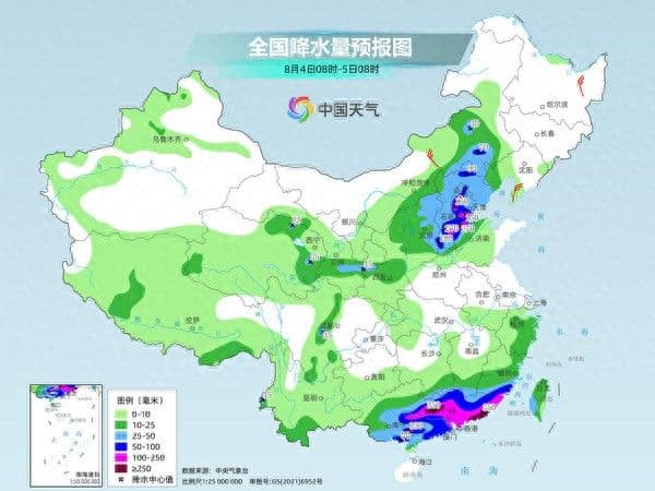
Every year, braces itself for a critical period of intense weather known colloquially as '七下八上' (Qī Xià Bā Shàng), or 'Seven Up, Eight Down'. This traditional meteorological term precisely marks the peak of the country's flood season, typically spanning from late July to early August. During these pivotal weeks, northern regions, especially , parts of the , and the , experience a dramatic surge in precipitation. It’s a concentrated burst, with some areas receiving a staggering one-third of their annual rainfall within this single month. What makes this period so formidable? It's the unique atmospheric dance: the northward advance of the summer monsoon pushes its moisture-laden edge into the north, while a stable subtropical high-pressure system acts as a vast conveyor belt, channeling warm, humid air from the oceans. When this tropical humidity collides with cooler air masses descending from the north, particularly over the complex terrains of the and mountain ranges, the stage is set for widespread, often extreme, downpours. Understanding this annual reckoning is the first step in appreciating summer weather crucible.

Where Forces Collide: The Mechanics of Extreme Rainfall
Delving deeper into 'Seven Up, Eight Down' reveals a sophisticated interplay of meteorological forces that often culminates in extreme rainfall. This period critically overlaps with the most active phase for typhoons in the . As these powerful storms track northward, they become potent engines, ferrying enormous quantities of water vapor inland. Imagine a colossal atmospheric squeeze: this super-saturated warm air, propelled by the subtropical high and amplified by northward-bound typhoons, then slams into cooler air currents migrating south. The collision itself is a recipe for heavy rain, but the geography of adds another critical ingredient. Mountain ranges like the and act as natural barriers, forcing the moist air to rapidly ascend. This topographic lifting cools the air further, condensing vast amounts of moisture into torrential downpours. We saw this devastatingly in 2023 when 's remnants, after making landfall, continued their northward journey, unleashing record-breaking rainfall across , the region, and . These aren't just isolated incidents; they are textbook examples of how moisture, temperature differentials, and terrain conspire to create some of the most challenging weather events.

Beyond the Warnings: Navigating a Shifting Climate Reality
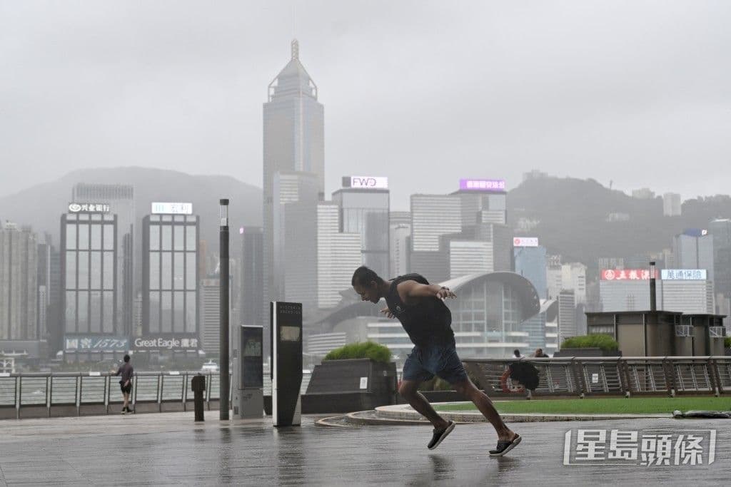
While daily forecasts provide crucial immediate guidance, the consistent issuance of severe weather warnings during 'Seven Up, Eight Down' speaks to a larger narrative: a palpable shift in climate reality. The frequently issues multiple high-level alerts simultaneously – orange warnings for both extreme heat and torrential rain, alongside blue warnings for strong convective weather and even specific alerts for waterlogging risks. This convergence of hazards underscores the increasing complexity and extremity of summer weather events. Take the rainy season, which began an unprecedented 13 days earlier than usual in 2023, the earliest start since records began in 1961. This isn't merely an anomaly; it's a stark indicator of changing precipitation patterns, with rainfall zones shifting northward and overall volumes increasing significantly in regions like and . These trends suggest that what was once considered extreme is becoming more frequent, urging us to look beyond immediate warnings and truly grapple with the long-term implications of a climate that is demonstrably changing.
Fortifying the Front Lines: Strategies for Community Resilience
In the face of these intensifying weather challenges, proactive adaptation and robust community resilience are not just desirable, but essential. Governments and local authorities are implementing multi-pronged strategies, starting with enhanced early warning systems and public dissemination of real-time meteorological information. This means not only issuing alerts for rainstorms, heatwaves, and strong convection, but also providing clear, actionable defense guidelines. Key among these are immediate safety protocols: suspending outdoor work, cutting power in hazardous areas, and crucially, closing schools and businesses in high-risk zones to protect vulnerable populations. Beyond immediate response, there's a strong emphasis on infrastructure preparedness, such as optimizing urban and agricultural drainage systems to mitigate waterlogging, and reinforcing structures against high winds. Furthermore, preventing secondary disasters like flash floods, landslides, and mudslides in geologically fragile areas is paramount. This comprehensive approach, combining advanced forecasting with diligent preparedness and community-wide engagement, is how aims to fortify its front lines against the unpredictable and often extreme atmospheric alchemy of its mid-summer crucible.
Related Articles
The Volatile Canvas: Navigating Summer's Extreme Heat and Sudden Storms Across China
The Volatile Canvas: Navigating Summer's Extreme Heat and Sudden Storms Across China

Beyond the Deluge: Navigating the New Normal of Weekly Weather
Beyond the Deluge: Navigating the New Normal of Weekly Weather

Weather Whiplash: Navigating Korea's Shifting Summer Skies
Weather Whiplash: Navigating Korea's Shifting Summer Skies
Weather's Unseen Hand: How Coastal Megacities Master the Storm's Rhythm