Decoding the Drizzle: Unraveling the Evolving Story of Our Skies
Unravel the secrets behind weather forecasts. Learn how models, radar, and observations shape predictions, understand uncertainty, and read the sky like a pro.
The Invisible Architecture of Prediction
Have you ever wondered what truly underpins the daily weather forecast? It's far more than just a quick glance at a satellite image. At the heart of modern weather prediction lies an intricate, invisible architecture of sophisticated numerical weather models. These aren't just simple algorithms; they are colossal computational systems, constantly crunching vast amounts of atmospheric data from around the globe. Imagine supercomputers tirelessly processing measurements of temperature, pressure, humidity, and wind from countless sensors, balloons, and buoys. They then apply complex mathematical equations, rooted in the laws of physics, to simulate how the atmosphere will evolve over time. The output of these models comes in the form of diverse weather maps and graphs, which, when interpreted correctly, form the very backbone of the weather forecasts we rely on. Understanding these foundational models is the first step in truly appreciating the science behind tomorrow's forecast.
Real-Time Whispers: Radar, Satellites, and Immediate Insights
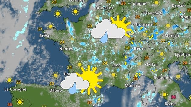
While sophisticated models lay the groundwork for longer-range forecasts, the immediate future of our skies often whispers its secrets through real-time observations. For the very short term – think hours, not days – traditional weather maps become less critical. Instead, our eyes turn to the dynamic dance captured by and . Satellite images offer a broad, sweeping view of cloud formations, revealing their type, movement, and potential for development. Radar, on the other hand, is our indispensable tool for tracking precipitation, showing us where rain, snow, or hail are falling, how intensely, and in which direction they're heading. These visual insights are complemented by a wealth of ground-level observations: precise measurements of temperature, atmospheric pressure, wind speed, and direction from countless stations. This live data allows meteorologists to fine-tune forecasts at the last minute, offering crucial, on-the-spot adjustments to predicted conditions.
The Fluidity of Forecasts: Embracing Uncertainty
If you've ever felt frustrated by a forecast that changed overnight, you're not alone. But rather than seeing this as a flaw, it's an invitation to understand the inherent fluidity of atmospheric prediction. The atmosphere is a wonderfully chaotic system, where tiny changes in initial conditions can lead to vastly different outcomes days later – often called the 'butterfly effect.' This means that even the most powerful can't perfectly capture every variable. Forecasts, therefore, come with an inherent degree of uncertainty. This is why you might see a '75% certainty' alongside a prediction for rain. Meteorologists often use 'ensemble forecasting,' running models multiple times with slight variations in their starting data to create a range of possible outcomes. The more these outcomes converge, the higher the certainty. Understanding this dynamic helps us embrace forecast updates not as errors, but as continuous refinements based on newly acquired data and evolving atmospheric conditions.
Beyond the Data: Experiencing the Atmosphere
While models and real-time data provide the scientific framework, there's an equally vital, often overlooked, dimension to understanding weather: direct personal experience. Stepping outside and observing the sky, feeling the wind, or noticing changes in the air pressure can offer a profound, nuanced perspective that no digital display can fully replicate. How do the clouds look? Are they towering cumulonimbus signaling a coming storm, or wispy cirrus hinting at fair weather? Is the wind picking up, and from what direction? These sensory observations, combined with a basic understanding of atmospheric principles, allow you to connect the abstract numbers and symbols to the tangible world around you. This isn't about replacing forecasts, but enriching them. It's about developing an intuitive feel for local conditions, recognizing how they align with or diverge from predictions, and truly appreciating the dynamic tapestry of our atmosphere.
Becoming Your Own Sky Savant
So, how do you move beyond passively receiving forecasts to becoming a true 'sky savant'? It starts with active engagement. Begin by exploring the raw data sources that meteorologists use – the very weather maps, radar, satellite images, and observation data mentioned earlier. Many of these resources are readily available online. Learn to interpret the pressure systems, the wind patterns, and the movement of precipitation. Critically cross-reference different sources: how does a model's long-range prediction compare with the latest radar scan? How do local observations confirm or contradict the forecast? Developing this critical eye and the ability to synthesize information from various data streams will empower you. It's a continuous learning process, fostering not just a deeper understanding of weather, but also a more informed appreciation for the intricate, ever-changing story unfolding above our heads.
Related Articles
The Whispering Sky: Unveiling the Local Stories Behind Every Forecast
The Whispering Sky: Unveiling the Local Stories Behind Every Forecast
The Atmosphere's Dance: Unveiling the Secrets Behind Daily Weather
The Atmosphere's Dance: Unveiling the Secrets Behind Daily Weather

The Sky's Whisper: Navigating Life's Atmospheric Rhythms
The Sky's Whisper: Navigating Life's Atmospheric Rhythms
Beyond Barometers: The Unexpected Stories Woven by Our Weather