Unseen Waters Rising: Navigating the Philippines' Red Rainfall Warnings
Uncover the critical role of red rainfall warnings in the Philippines. Explore monsoon science, forecasted impacts, and collaborative efforts protecting communities from rising waters.
The Colors of Caution: Understanding the Rainfall Alert System
When heavy rains loom over the , the public often hears about color-coded warnings issued by the .
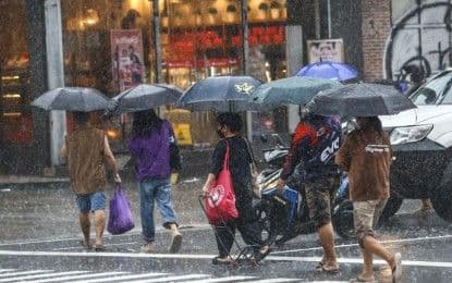
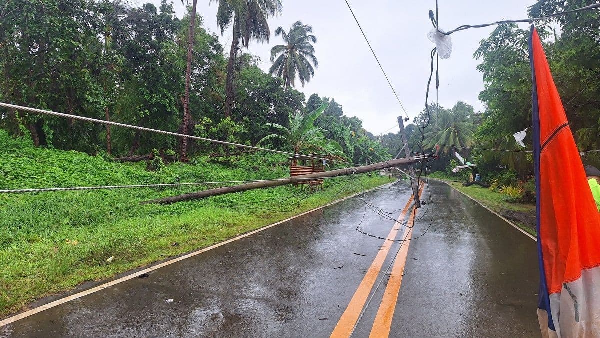
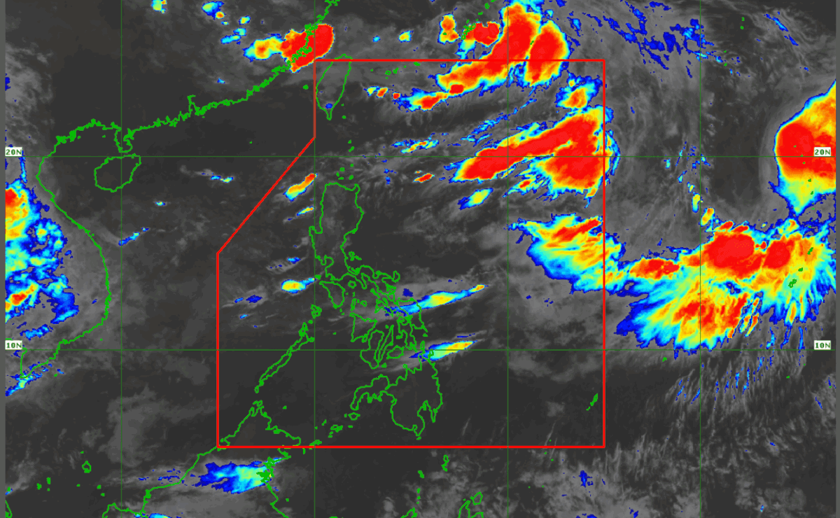
These aren't just arbitrary hues; they form a crucial, life-saving system designed to communicate risk and prompt action. At the forefront is the Red Rainfall Warning, signaling intense rainfall – typically 100 to 200 millimeters or more within a specific timeframe – and demanding immediate, critical response. This highest alert level means that severe flooding is highly probable in urbanized, low-lying areas, and particularly near rivers where water levels can rise rapidly. For communities nestled in mountainous or hilly terrain, the Red Warning also carries a grave implication: the heightened risk of landslides in highly susceptible areas. 's diligent monitoring, often tracking systems like low pressure areas, directly informs these warnings, providing indispensable foresight that allows authorities and residents to prepare for, and hopefully mitigate, the worst impacts of nature's fury. Understanding what each color signifies empowers Filipinos to act decisively when every drop counts.

Monsoon's Embrace: Unpacking 'Habagat' and LPAs
Behind the urgent calls of a Red Rainfall Warning often lies the pervasive influence of the 'habagat,' or southwest monsoon, a seasonal wind system that ushers in a significant portion of the 's annual rainfall. This atmospheric embrace, while vital for agriculture, can turn dangerous when intensified by other weather phenomena. Low Pressure Areas (LPAs) are frequent companions to the habagat, acting as rain-generating engines. These swirling masses of clouds and thunderstorms, even if they don't fully mature into tropical depressions or storms, can significantly enhance the monsoon's downpour, leading to prolonged periods of heavy to intense rainfall across vast swathes of the archipelago, particularly the western portions of and parts of the . Imagine the cumulative effect: a persistent habagat, already saturated with moisture, gets an additional boost from an LPA, turning what might be a nuisance into a serious threat. It's this complex interplay of natural forces that meteorologists meticulously track, providing the foundational data for those critical rainfall warnings.
On the Frontlines: Predicting and Protecting Communities
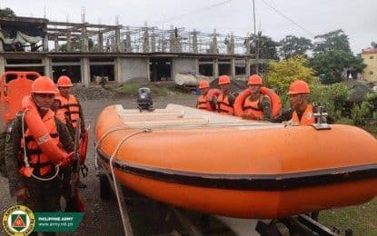
Translating meteorological forecasts into actionable protection is where the intricate machinery of disaster response truly comes alive. When issues a Red Rainfall Warning, it triggers a cascade of coordinated efforts among various government agencies, spearheaded by the and the . These bodies don't just react; they convene high-level meetings, aligning strategies across departments to safeguard lives and property. The synergy is palpable: provides the scientific backbone, forecasting persistent heavy rainfall and identifying areas vulnerable to flooding and landslides. But this technical data is then enriched by real-time ground information from , who are literally on the frontlines. This collaborative model ensures that operational decisions are based on the most up-to-date, comprehensive picture, allowing for early action, resource deployment, and a proactive stance against the unfolding weather event. It’s a testament to the unseen efforts and dedicated professionals working tirelessly to protect every Filipino community.
Rising Waters, Rising Resilience: Building Preparedness from Ground Up
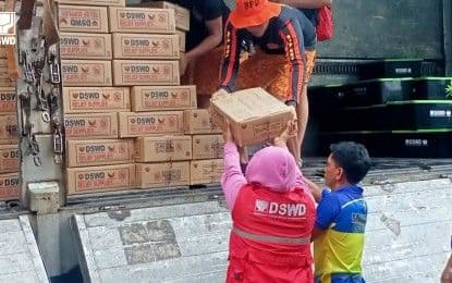
While national agencies orchestrate the overarching disaster response, the true crucible of preparedness often lies at the local level. are not merely recipients of warnings; they are the crucial link in building community resilience from the ground up. Their ability to gather real-time ground data, assess vulnerabilities, and implement localized early warning and evacuation protocols is paramount. These efforts are not just about reacting to a Red Rainfall Warning, but about embedding a broader climate resilience strategy into the fabric of daily life. This involves continuous monitoring, educating residents on what to do when warnings are issued, and ensuring that aid and support mechanisms, like those from the , are ready to be deployed. The goal is to move beyond mere survival to proactive adaptation, fostering a culture where communities understand the risks posed by extreme weather and possess the knowledge and resources to protect themselves, transforming potential victims into active participants in their own safety.
Related Articles
Weathering the Storm: Unpacking Resilience in a Deluge-Prone Nation
Weathering the Storm: Unpacking Resilience in a Deluge-Prone Nation
Beyond the Daily Bulletin: Decoding the Philippines' Shifting Skies
Beyond the Daily Bulletin: Decoding the Philippines' Shifting Skies

Philippine Skies Under Siege: Decoding the Double Whammy of Tropical Storms and Monsoon Rains